
Owning a slice of semi-rural land in Western Australia sounds like a dream. The open space, the privacy, the possibility of a small hobby farm or vineyard just outside your back door. But before you break ground or plan your next project, there is one thing every landholder needs to understand: the rules governing your property are more layered than most people expect.
The rural residential zone Western Australia planning framework shapes what you can build, how far from the boundary you must build it, and what activities are permitted on your land. Underpinned by State Planning Policy 2.5 and individual local planning schemes, this system was designed to balance lifestyle living with the protection of vegetation, agricultural land, and natural resources across a rapidly growing state.
This guide is written for landholders who are new to rural residential planning. It covers the regulatory framework, development standards, permitted uses, land use conflict, sustainability considerations, and heritage obligations. By the end, you will have a clear and confident understanding of your rights, your responsibilities, and the practical steps required to make the most of your property.
What Is the Rural Residential Zone?
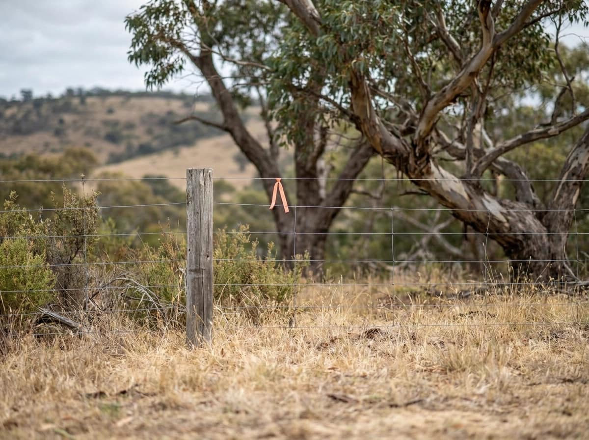
The Rural Residential zone is a distinct planning category in Western Australia designed to accommodate semi-rural living on lots typically ranging from 1 to 4 hectares. These lot sizes are deliberately chosen to retain native vegetation, natural landform, and the distinguishing landscape features of rural land, while still permitting a comfortable residential lifestyle with limited agricultural activity.
How It Differs from Other Zones
This zone sits between two more familiar categories, and understanding where it sits helps clarify what it permits.
Standard residential zones are governed by the Residential Design Codes, which apply to urban and suburban lots. Those zones prioritise density and neighbourhood amenity at a suburban scale, with lot sizes typically measured in square metres rather than hectares.
General rural or agricultural zones sit at the other end of the spectrum, with much larger minimum lot sizes and a primary focus on productive land use. Residential amenity and landscape retention are secondary considerations in those zones.
The Rural Residential zone occupies the middle ground: smaller than agricultural holdings, larger than suburban blocks, and explicitly designed to balance residential comfort with landscape conservation. Permitted uses include single dwellings and hobby farming; prohibited uses include intensive agriculture and industrial activity.
Primary Purpose
The zone’s core intent is to preserve landscape character and biodiversity values while enabling residents to maintain a genuine connection to the land. This means building envelopes are shaped around vegetation retention, not just setback minimums, and the overall design framework actively resists the suburbanisation of rural land.
Governing Documents
Two layers of policy govern Rural Residential development in WA. At the state level, State Planning Policy 2.5 (SPP 2.5) provides the strategic framework for land use planning in rural areas. At the local level, individual councils translate SPP 2.5 into specific zoning provisions, land use tables, and development standards through their local planning schemes. Both layers matter, and the sections that follow examine each in detail.
The Regulatory Framework: SPP 2.5 and Local Planning Schemes
Those key documents don’t just describe the zone, they carry legal weight and shape every development decision you’ll make on rural residential land.
State Planning Policy 2.5 (SPP 2.5) is the foundational state-level instrument governing land use planning in rural and rural living areas across Western Australia. Prepared by the Western Australian Planning Commission (WAPC) under Part 3 of the Planning and Development Act 2005, it carries formal statutory standing and must be applied across all tiers of planning decision-making. Its stated purpose is to protect and preserve Western Australia’s rural land assets given their economic, environmental, food production, and landscape values.
The policy emerged directly from population pressure. The earlier 2013 version was drafted in response to WA’s population being forecast to exceed 2.4 million by 2026. The current December 2016 version projects further growth to more than five million people by 2061. Both versions identify the same core tension: growing demand for urban settlement, economic development, infrastructure, conservation, and food production is placing intensifying and often competing pressure on a finite rural land base.
How the Two-Tier System Works
SPP 2.5 sets the strategic direction at state level. Individual local government planning schemes then translate that direction into locally specific development standards, permitted use tables, and assessment criteria. This means the state policy establishes the principles, while your council delivers the rules that actually govern your property.
The practical consequence is meaningful variation between jurisdictions. A Rural Residential lot in Nannup is governed by the Shire of Nannup’s local planning scheme; a comparable lot in Denmark falls under the Shire of Denmark’s scheme. Minimum lot sizes, setback specifications, and discretionary use categories can all differ. Assuming that standards applying in one council area apply in another is a common and costly mistake.
Before making any purchase or development decision in a Rural Residential zone, read your specific local planning scheme carefully. Understanding both the statutory approvals process and how local scheme provisions interact with state policy is essential groundwork. The residential project guide for clients covering stages, approvals, budget and design provides a useful overview of how planning approvals fit within the broader project lifecycle.
The WAPC’s role extends beyond policy-making. It holds direct statutory authority over subdivision applications and structure plan endorsements within Rural Residential zones, operating above local council level. Where no WAPC-endorsed strategic planning instrument exists for an area, SPP 2.5 applies directly to fill that gap.
Development Standards at a Glance
Once your local scheme translates SPP 2.5 into site-specific rules, those rules become concrete numbers your design must hit. Here are the key standards that apply to most Rural Residential zones in Western Australia.
Setbacks
The standard minimum setbacks are 20 metres from the front boundary, 10 metres from the rear, and 10 metres from each side boundary. These generous distances are not arbitrary. They preserve the open, vegetated character that distinguishes Rural Residential land from suburban lots, and they reduce friction between neighbouring properties by keeping structures well clear of shared boundaries. On a 1 to 4 hectare lot, these setbacks still leave a workable building area, but they do meaningfully shape where on the site your home can sit.
Building Height
The typical height cap is 9 metres. On a flat lot this is straightforward to calculate. On sloping rural land, height is measured from natural ground level, which means a split-level design on a steep site can reach the limit faster than expected. Sloping topography requires careful storey-by-storey height checking during the design phase, not as an afterthought.
Building Envelopes
Every dwelling in a Rural Residential zone must sit within an approved building envelope, a three-dimensional volume defining exactly where structures may be placed. This goes further than setbacks alone. Setbacks establish minimum distances from boundaries; the building envelope prescribes the complete permissible volume, including height, footprint, and siting. Your envelope will appear on a Structure Plan, Local Development Plan, or an approved envelope plan specific to your lot. Limited exceptions exist outside the envelope, including access driveways, rainwater tanks as approved by local government, boundary fencing, and approved bushfire management works.
Water Storage
Where reticulated water is unavailable, each dwelling must have a minimum 135,000 litres of on-site water storage. This is a substantial volume. Tank placement, screening, and integration with the site drainage and firefighting access all need to be resolved early in the design process, not after the house footprint is fixed.
Additional Constraints
Local schemes layer further requirements on top of these baseline standards. Bushfire Attack Level (BAL) assessments can restrict what the building envelope may actually contain in terms of materials and openings. If your property sits in a designated bushfire-prone area, the construction and design implications are significant. Effluent disposal setbacks and vegetation clearing restrictions can further compress the usable area within an already-defined envelope. Always verify which overlays apply to your specific lot before committing to a site layout.
What Can You Build? Permitted and Discretionary Uses Explained
Once you understand the development standards that govern how to build, the next question is what you can build. The Rural Residential zone organises land uses into three categories: permitted, discretionary, and prohibited.
Permitted Uses (‘P’)
Permitted uses are approved as-of-right, meaning no separate use approval is required provided your proposal meets all relevant development standards. Uses in this category typically include single dwellings, rural pursuits and hobby farms, home occupations, and community purposes, though the precise list varies between council schemes and should be confirmed against your specific local planning scheme before any commitment.
If you are considering a community infrastructure project in a rural setting, understanding how to ensure the success of community infrastructure projects is worth reading early.
Discretionary Uses (‘D’)
Discretionary uses are not permitted by default. Council must grant formal development approval before any such use commences. Uses in this category can include rural home businesses, holiday houses, ancillary dwellings such as granny flats or workers’ quarters, and others depending on the scheme, confirm the classification for any specific use with your local council before proceeding.
Some discretionary uses are also classified as advertised (‘A’), requiring public notification before council can assess the application. The process typically involves:
- Lodging a development application with supporting documentation
- Advertising (for ‘A’ uses) to notify neighbours and allow public comment
- Council assessment against local scheme objectives and State Planning Policy 2.5, which emphasises protecting rural land and avoiding land use conflict
- Conditional approval addressing scheme compliance requirements
Prohibited Uses (‘X’)
Certain uses fall entirely outside the zone’s intent. Intensive agriculture, industrial activities, and multiple dwellings on a single lot are typically prohibited. These cannot be approved regardless of design quality or council discretion.
Why Council Variation Matters
Use classifications are not uniform across Western Australia. A use that is permitted under the Shire of Nannup’s scheme may be discretionary or prohibited under a neighbouring council’s scheme. Before purchasing land or investing in design work, check your specific local planning scheme carefully. Engaging an architect or planning consultant at the feasibility stage can prevent costly assumptions about what your lot will actually support.
Managing Land Use Conflict in Rural Residential Areas
Knowing what you can build is only half the picture. Where and how you build it matters just as much, particularly when your neighbours are running working farms.
Rural Residential zones increasingly abut working farms and rural infrastructure, the result is predictable amenity conflict. Noise, dust, odour, and spray drift generate complaints, and amenity expectations collide with established land use rights.
Separation Distances: The Primary Planning Tool
SPP 2.5 and local planning schemes address this tension chiefly through separation distance requirements. These buffers define the minimum gap required between a sensitive land use (your dwelling) and an incompatible one, such as a piggery, intensive animal husbandry facility, or spray irrigation operation. The WA Department of Health’s guidelines for separation of agricultural and residential land uses provide the technical framework underpinning these distances, drawing on CSIRO research to address health and amenity impacts. Where a proposed lot falls within a prescribed separation distance, approval may be refused or conditioned.
The ‘Right to Farm’ Consideration
WA planning policy does not codify a formal “right to farm” doctrine, but the intent is clear: SPP 2.5 explicitly prioritises protecting established agricultural land from encroaching residential uses. In practice, this means that if you purchase a Rural Residential lot next to an existing piggery or broadacre operation, your ability to complain about noise, odour, or spray drift is significantly limited. The agricultural use came first. Landholders who do not investigate neighbouring land uses before purchasing can find themselves with few remedies.
Design as a Conflict Mitigation Tool
Careful architectural design can meaningfully reduce conflict exposure and support development approval outcomes. Designing every part of your home to work harder from the start pays dividends here: building orientation that positions habitable rooms away from conflict sources, dense landscaping buffers on affected boundaries, acoustic screening through earth mounding or solid fencing, and siting outdoor living areas on the sheltered side of the dwelling all reduce amenity impact without requiring neighbours to change their operations.
A Sharpening Contest Over Rural Land
SPP 2.5 acknowledges directly that rural land resources are becoming increasingly contested, with settlement, conservation, infrastructure, and food production interests competing more sharply as regional WA’s population grows. For landholders, this trend means conflict risks are rising, not stabilising, and proactive design responses are becoming a planning expectation rather than a bonus.
Climate Change and Sustainability in Rural Residential Planning
Land use pressure is not the only external force reshaping Rural Residential development in Western Australia. Climate change is now a recognised planning consideration in its own right, and it is altering the assumptions that underpin basic infrastructure decisions.
Water Supply and Changing Rainfall Patterns
Where reticulated water is unavailable, the situation on many Rural Residential lots, that 135,000-litre minimum storage requirement becomes the baseline, not the ceiling. With rainfall variability increasingly relevant to off-grid water planning, building in storage capacity beyond the regulatory minimum is a prudent design decision. Conservative, adaptive water management strategies, including oversized catchment areas, secondary storage tanks, and seasonal usage planning, are increasingly prudent from the design stage.
Off-Grid Energy Servicing
Grid electricity connection is expensive or simply unavailable on many remote Rural Residential lots. Off-grid solar and battery systems have moved from an optional upgrade to a core servicing consideration that architects and planners factor in early. Sizing a system correctly requires understanding the home’s orientation, roof geometry, and energy loads before construction begins, which is precisely why energy servicing belongs in the concept design conversation, not as a late addition.
Bushfire-Resilient Design
Where a Rural Residential lot sits in a designated bushfire-prone area, local scheme provisions and state fire safety requirements will influence construction standards and vegetation management, factors that need to be confirmed with your local council and fire authority at the concept stage. These requirements demand careful architectural integration to avoid compromising thermal performance, natural light, or livability. Understanding how constraints drive better design outcomes is central to this challenge, as bushfire compliance and passive design must be resolved together, not in sequence.
Beyond Minimum Standards
SPP 2.5 explicitly identifies managing environmental and landscape attributes as a core policy objective, including reducing pressure from natural resource degradation. A well-designed Rural Residential home can actively advance these goals. Passive solar orientation reduces energy demand. Greywater reuse systems lower potable water consumption. Biodiversity-sensitive landscaping supports native habitat rather than fragmenting it. These strategies reduce long-term operating costs for landholders while contributing to the environmental outcomes the policy framework is designed to protect.
Heritage Properties Within Rural Residential Zones
Beyond sustainability performance, Rural Residential lots in regional WA carry another layer of complexity that buyers and landholders frequently overlook: heritage significance.
Many lots contain or adjoin pre-federation farmsteads, vernacular outbuildings, pastoral infrastructure such as shearing sheds and stone water catchments, or culturally significant landscapes with Aboriginal heritage values. These features do not disappear from the planning frame simply because a lot has been rezoned for rural residential use.
The Heritage Planning Overlay
Where a property is heritage-listed, development decisions involve more than the local planning scheme. Heritage-listed properties may be subject to the State Heritage Register and/or local government heritage lists, and individual properties may also be subject to heritage management plans. Each instrument can impose specific conditions on what alterations, extensions, or demolition work is permissible, independently of standard Rural Residential zone development standards. A compliant setback or building envelope does not guarantee heritage approval.
Adaptive Reuse as a Practical Strategy
Existing farm buildings on heritage properties offer genuine opportunity. Sensitively converting a stone woolshed, timber implement shed, or brick dairy into ancillary accommodation, an artist’s studio, or storage can add meaningful functional value to a property. Crucially, adapting an existing structure often carries a lighter discretionary approval burden than constructing an equivalent new building. The built form already exists; the planning question shifts from whether to allow new construction to whether the proposed use is compatible with the heritage fabric.
Farmstead Transformation
Upgrading an existing rural homestead rather than building new is an emerging project type with particular relevance in regional WA. This approach balances contemporary performance requirements with careful preservation of the materials and spatial character that define the building’s heritage significance. Thinking through this before you commit to any scope is covered well in this guide to renovating your existing home, which addresses heritage, approvals, and budget sequencing for WA property owners.
The Case for Heritage-Accredited Expertise
Navigating a heritage-listed Rural Residential property means working across two regulatory systems simultaneously. An architect with heritage accreditation and direct experience in regional WA planning brings specific value here: interpreting heritage management plan conditions alongside local scheme development standards, advising on adaptive reuse pathways, and preparing documentation that satisfies both the heritage authority and the local council assessment process.
How an Architect Can Help You Navigate Rural Residential Planning
The same layered complexity that makes heritage projects demanding applies across all Rural Residential development. An architect’s value is in converting that complexity into clear decisions before it becomes costly confusion.
Reading the Building Envelope
Local scheme provisions for setbacks, height limits, and building envelopes are written for planners, not landholders. A qualified architect translates these controls into a site analysis that maps the usable building area and flags height interactions with site topography. On lots with natural topography, this interpretation can substantially change what is financially viable to build.
Preparing Discretionary Approval Applications
Discretionary applications demand structured justification, an architect prepares the design rationale report, addresses scheme objectives directly, and manages consultation. That structured preparation materially improves approval prospects.
Integrating Sustainability from the Start
Passive solar orientation, rainwater harvesting infrastructure to meet the 135,000-litre minimum storage requirement, off-grid renewable energy systems, and biodiversity-sensitive landscaping all perform better and cost less when they are embedded in the concept design rather than added afterwards. Understanding what landscape architecture contributes to a WA property is part of this integration, particularly where lot vegetation and landform are planning considerations in their own right.
The Regional Advantage
A regional architect with established relationships with local planning officers and direct knowledge of how individual councils interpret their schemes brings a practical advantage that generic advice cannot replicate. Familiarity with the specific character of rural WA landscapes, the variation between councils such as Nannup and Gosnells, and the expectations of local decision-makers reduces delays and avoids the redesign cycles that follow uninformed applications.
If you are planning to develop, extend, or seek discretionary approval in a Rural Residential zone, speak with a regional architect before submitting anything. Early engagement costs far less than redesigning after a refusal.
Key Takeaways for Rural Residential Landholders
Rural Residential planning in WA operates across state (SPP 2.5) and local (council scheme) tiers, with development standards and use classifications the non-negotiable baseline, refer to the relevant sections above for the specific figures.
What you can build depends entirely on use classification. Permitted uses proceed as-of-right when development standards are met. Discretionary uses require a formal development application with documented justification against scheme objectives. Preparation and quality of evidence directly affect outcomes; under-prepared applications face delays, conditions, or refusal.
Three considerations are reshaping Rural Residential development right now. Climate change is altering the reliability of rainwater harvesting assumptions, making adaptive water management a design necessity rather than an afterthought. Land use conflict between residential occupants and neighbouring agricultural or rural industrial operations is intensifying as regional WA populations grow. And sustainability integration, covering passive design, renewable energy servicing, and biodiversity outcomes, is increasingly expected in new builds and major extensions, not treated as optional.
The single most effective action you can take before any decision is to read your local planning scheme. Schemes vary between councils, and a provision that permits a use in one local government area may classify the same use as discretionary or prohibited in another.
Whether you are purchasing land, planning a new home, extending an existing dwelling, or seeking approval for a rural home business, engage a qualified architect with direct experience in the regional WA planning context before lodging anything. Early professional input protects your investment, clarifies what is genuinely achievable on your lot, and positions any application for the strongest possible outcome.