
On a Perth Hills block, the most expensive decisions are often made before a single wall is drawn. Slope, bushfire attack level, trees, water supply, and firefighting access can determine where a house can sit, how it is built, and what the project costs. Treat the floor plan as the starting point, and you risk redesign, engineering changes, and approval delays. Treat the site analysis as the starting point, and you give the design a realistic framework.
This tutorial explains why site analysis comes before the floor plan. We will examine how BAL assessment sets your material palette and what each rating changes. We will cover slope, cut and fill, retaining, and access. We will look at where vegetation retention rules pull against BAL, and how water supply and firefighting access shape driveways. Finally, we will connect site strategy to budget and outline what to do before you commit to a hills block. By the end, you will see why resolving the site first lets you draw a home that can be approved, built, and costed with fewer surprises.
Why the Site Analysis Comes Before the Floor Plan in the Hills
On a Perth Hills block, the site sets the budget before the floor plan. BAL, slope, tree retention and firefighting access each add or remove options before a room is drawn.
Four constraints matter:
- Bushfire Attack Level (BAL) rates exposure to ember, radiant heat and burning debris under AS 3959.
- Effective slope and cut and fill: how steeply land falls under vegetation, and how much earth must move for a pad.
- Tree retention and tree protection zones: which trees stay, and where roots and canopy exclude building.
- Water supply and firefighting access require a firefighting tank, pump and appliance-ready driveway.
A hills site analysis contains a contour and detail survey, vegetation survey with species and density, bushfire prone area mapping via DFES, council overlays for the relevant shire (Mundaring and Kalamunda differ), and a geotechnical assessment.
The metro default is a flat block, connected services, no vegetation constraint, plan first. In the hills, the site strategy is a design document in its own right and usually the cheapest part to get right.
Resolving that strategy first tends to make design cheaper; leaving it late lets engineering and approval changes consume savings. Treat this as a principle to be tested, not a guarantee. The article shows where costs land.
Each constraint is explained in turn, connected to buildability and cost, then summarised as a pre-commitment checklist. Before commissioning drawings, understand how bushfire-prone area rules apply: Building in a Bushfire Prone Area: What WA Property Owners Need to Know.
BAL Assessment: The Rating That Sets Your Material Palette
A Bushfire Attack Level (BAL) measures a building’s potential exposure to radiant heat, ember attack and burning debris. It runs from BAL-Low through BAL-12.5, BAL-19 and BAL-29 to BAL-40 and BAL-Flame Zone, and is determined under AS 3959 and WA’s bushfire planning policy, State Planning Policy 3.7. Confirm both are the current versions before you rely on any rating.
Assessors work from four inputs: the vegetation class and its distance from the building, the effective slope beneath that vegetation, the area’s fire danger index, and the intended building envelope. Slope is the input metro clients underestimate most, because bushland below a house rates higher than identical vegetation on flat ground. Fire runs faster uphill.
The practical first step is mapping. Check the lot against DFES bushfire prone area mapping and your council’s planning scheme, since designation triggers assessment requirements at planning or building approval stage.
Commission the assessment before concept design, through an accredited bushfire assessor, and again if the vegetation or building envelope changes. A rating tied to a superseded layout carries no weight at approval.
Councils including Mundaring and Kalamunda layer their own planning requirements over state policy, so identical vegetation and slope can produce a different approval path in the next shire.
BAL is not confined to the house. Decks, carports, sheds, water tanks and sometimes fencing are all caught, and so is the garden edge, meaning landscape design in WA needs to work with the rating rather than against it. These ancillary elements are usually the last things a client wants to redesign.
What Each BAL Rating Actually Changes
Each rating band carries its own construction requirements under AS 3959, and the jump between bands is where budgets move.
- BAL-Low and BAL-12.5: conventional construction with modest ember protection. Most standard material selections survive with minor detailing changes.
- BAL-19 and BAL-29: the design visibly changes. Window and door protection, bushfire-resistant decking, upgraded glazing, roof and gutter detailing, and reduced openings on exposed elevations.
- BAL-40 and BAL-FZ: non-combustible walls, protected or limited glazing, shielded openings and flame zone detailing push cost and constrain geometry. BAL-FZ limits where openings can sit at all.
These bands decide window sizes, façade composition, roof form, eaves and balcony detailing, so the number belongs in the brief before the elevation is drawn. The same sequencing applies when planning a kitchen renovation around your whole house: resolve the shell before the fittings.
Obtain the BAL before finalising a façade or selecting windows. A late rating turns a material preference into a variation.
Slope, Cut and Fill: What Your Block’s Contours Decide
With the BAL number settled, the contours are the next constraint, and often the most expensive.
Begin with the detail survey. Establish the average slope across the envelope you are considering, the direction it falls, and whether a practical building pad exists without shifting half the site.
Cut and fill is simple in principle. Cutting into the hill creates a level pad and an uphill retaining wall; filling creates a downhill wall. Most hills projects do both. Retaining is structural, not decorative, and in practice is frequently the largest single site cost.
Slope also governs access. A grade a car handles comfortably may not satisfy fire appliance requirements, and long benched driveways add retaining, drainage and earthworks costs that never appear on a floor plan.
Beneath all of it sit footings and slab selection, drainage behind retaining walls, and the geotechnical assessment that tells you what the soil will actually support.
House shape can help. Split-level and stepped floor plates reduce cut and fill and retaining height, so the design manages the earthworks budget rather than the reverse. How to choose a Perth architect for a modern home design covers what to look for when appointing someone to run that analysis.
Approvals follow. Earthworks and retaining above certain heights may need engineering certification and separate approval, and hills shires scrutinise drainage and run-off onto neighbouring land.
Retaining Trees: Where Vegetation Rules and BAL Pull Against Each Other
With the pad and retaining resolved, the trees decide what can be built around them. Hills shires protect vegetation through tree protection rules, canopy retention targets and planning conditions requiring retained trees or replacement planting, so removal is rarely a simple decision.
The tension is structural. The vegetation that drew you to the hills feeds straight into the BAL assessment, and retained trees can push the rating up a band. Clearing to drop the rating can breach tree protection rules or trigger approval conditions and neighbour objections.
Sequence matters. Survey and identify significant trees first, set the building envelope and driveway around them, then design inside the tree protection zones. Vegetation class, not tree presence alone, drives the assessment, and the classification must be confirmed by the assessor against the current standard rather than assumed from a site visit.
Get the order wrong and the cost is hidden but real. An envelope drawn for maximum floor area, then trimmed back by tree protection zones, can lose bedrooms, force a full redesign, or demand a retaining solution that was never budgeted. Keeping mature trees alive through construction is a known discipline, as this guide to staging a depot masterplan and retaining existing trees demonstrates.
A short conversation between the assessor, the council’s planning officer and your architect early on usually resolves the vegetation and BAL conflict before it becomes a design problem.
Water Supply and Firefighting Access: The Rules That Shape Your Driveway
With the tree conflict resolved early, the next fixed input is how firefighting water and appliances reach the building. Every bushfire prone site needs an on-site firefighting water supply, typically a dedicated tank volume with an independent pump or hydrant arrangement. It is sized to the relevant standard and your council’s requirements, not to household use alone.
Access rules are equally prescriptive: minimum driveway widths, maximum grades, passing and turning provisions, overhead clearance, and enough room for an appliance to reach the building and turn around. Long, steep hills driveways are where this bites hardest.
These requirements shape the site plan before the house does. Tank position, driveway alignment, turning area and building setback all interact, and the driveway often decides where the house can sit.
Requirements vary by local government. The City of Rockingham publishes council-level guidance, but hills clients need the equivalent from their own shire, so verify rather than rely on a general guide.
Retrofitting is the clincher: widening a driveway, adding a turn-around or relocating a tank after approval is expensive and disruptive. Resolve access and water in the site strategy first, alongside rural residential zoning considerations where relevant.
How the Site Strategy Drives the Budget
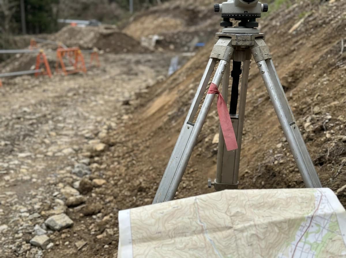
The cost argument is a mechanism, not a slogan. Unresolved BAL, slope and access questions do not disappear; they surface later as engineer rework, consultant re-fees, variation claims and approval delays. Those are the charges that consume early savings.
Hills budgets land in predictable places:
- Retaining walls and earthworks
- Driveway construction and access upgrades
- Glazing and non-combustible material upgrades
- The firefighting tank and pump
- Consultant fees for survey, geotechnical assessment and BAL assessment
The proportionality case. Survey, geotech and BAL work represent a small fraction of total build cost. Redesigning after engineering, or losing a room to a tree protection zone, does not. The same discipline that keeps well-designed sport and community facilities working for their users applies to a hills house: settle the constraints before you commit.
The counter-risk. Cutting the site budget too aggressively backfires. Clearing vegetation to lower the BAL can breach tree protection rules and create a more expensive approval problem than it solves.
The land-value angle. Pre-purchase due diligence on BAL, slope and access changes what a block is worth to you. That is information worth having before signing a contract, not after.
Office of Regional Architecture treats the site strategy as the first design deliverable, so BAL, slope, vegetation and access are resolved as a set before the floor plan is drawn.

What to Do Before You Commit to a Hills Block
Before you commit to a hills block, verify two things in parallel: bushfire prone status through the DFES Bushfire Prone Areas mapping and your local council, and a contour and detail survey so slope is measured, not estimated.
Commission the BAL assessment and geotechnical assessment early. Treat both as design inputs, not compliance paperwork to be gathered at approval stage.
Identify significant trees, canopy coverage and tree protection zones, then confirm in writing what your shire permits on clearing, retention and replacement planting. Rules differ between hills councils, and verbal advice is not enough. If your plans include a shed or outbuilding inside a tree protection zone, the approval pathway adds another layer, as set out in our guide to planning outdoor storage in regional WA.
Sketch the site strategy before the floor plan: building pad and levels, driveway alignment and grade, firefighting access and turn-around, water tank location, retaining strategy and drainage. Each element constrains the next.
Engage design professionals with hills experience early. Office of Regional Architecture works with clients across the Perth metro area and regional Western Australia, and a hills site visit and constraint review is where the process starts.
If you are buying or selling in a bushfire prone area, check disclosure and sale-related obligations. Confirm the current position with Consumer Protection WA rather than relying on older bulletins.
Conclusion: Resolve the Site, Then Draw the House

Everything in this guide points to one sequence. Commission the survey, BAL rating, geotechnical report and tree advice before you draw a floor plan, because each one can change where the house sits and what it is built from.
Budget from day one for the three cost drivers on any hills block: retaining and earthworks, BAL-driven materials and detailing, and driveway and firefighting access. Discovering them at tender is the expensive way to learn them.
Treat the BAL rating, tree protection zones and council requirements as fixed inputs, not negotiable preferences. Confirm each against current WA planning policy, AS 3959 and your own shire’s requirements before work begins.
If you want that site strategy resolved properly before committing to a plan, an architect experienced in Perth Hills constraints can run the analysis as the first stage of your project.